Lidaretto H32S(X)
Professional long-range SLAM scanner.
Cost-effective integration of Hesai XT32(M2X) Lidar with high-performing IMU in one compact unit, with a detachable 8K 360° camera. For your indoor and outdoor projects.


- 120 / 300 m Max range H32S / H32SX
- ±1 cm Range accuracy
- 32 Channels
- 640,000points/sec Single return H32S / H32SX
- 1 TB Internal memory
Why SLAM scanning?
SLAM (Simultaneous Localization and Mapping) is extremely effective way to capture accurate spatial 3D data for various professional applications using cost-effective devices.

Faster capture, fewer stops
Continuous capture. No tripod to set up, break down and carry to the next spot. The scanner records the whole time you walk.
Time savings. Continuous scanning reduces time spent repositioning equipment. The time saved depends on the site, route and required level of detail.
-
Works in GPS‑denied environments
Independent of satellites. The onboard Lidar and IMU track movement and map the surroundings without a satellite signal.
Indoor and underground access. Indoor spaces, underground mines, tunnels and heavily obstructed structures where GNSS cannot reach.
-
Fewer data gaps
More viewpoints. Walking around objects captures them from different angles and helps reduce gaps caused by obstructions at a fixed scanning position.
Fill gaps on site. Where access allows, walk around obstacles to capture hidden surfaces and reduce the need for a repeat visit.
-
Safer for the operator
Distance from hazards. Capture visible surfaces from accessible positions, helping limit the need to approach hazardous or hard-to-reach areas.
Less time on site. Faster capture can reduce time spent in hazardous areas. The resulting point cloud also supports remote inspection and planning.
-
Flexible and portable
Light hardware. Carry the H32S(X) by hand, on a harness or in a backpack to suit the site and scanning route.
Quick to learn. Minimal setup and parameter tuning simplify fieldwork. A planned route and basic operator training help achieve consistent results.
What's in your hand
Four parts, one compact handheld system. SLAM builds the map as you walk, so Lidaretto H32S(X) needs no GNSS, indoors or outdoors.

-
Hesai XT32 / XT32M2X Lidar
Best in class, 32 channels, ±1 cm range accuracy. 120 m max range on the H32S, up to 300 m on the H32SX.
-
Scanner body
Rugged design for most demanding environments, built-in high-precision IMU, 1 TB internal memory, fast USB-C data download, Wi-Fi connection and web interface.
-
360° camera
Detachable, superior 8K video resolution. For point cloud colorization and panorama images export.
-
Handle
Pistol grip for handheld scanning. Harness-mounted and backpack options also available.
-
Handheld
Grip and go. Walk rooms, corridors and stairs at your own pace.
-
Harness
Worn on a harness instead of carried in the hand.
-
Backpack
Comfortably on your back for large sites and outdoor routes.
Where to use Lidaretto H32S(X)
Wherever a tripod is too slow and GNSS is weak or missing. Every image below is a point cloud captured with a Lidaretto scanner.
-
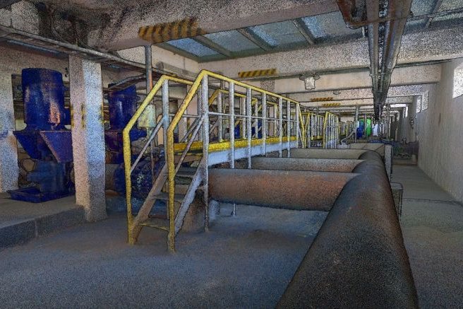
Digital twins of plants
Record halls, pump rooms and technology with every pipe and walkway. The colorized point cloud is the basis for digital twins and maintenance planning.
-
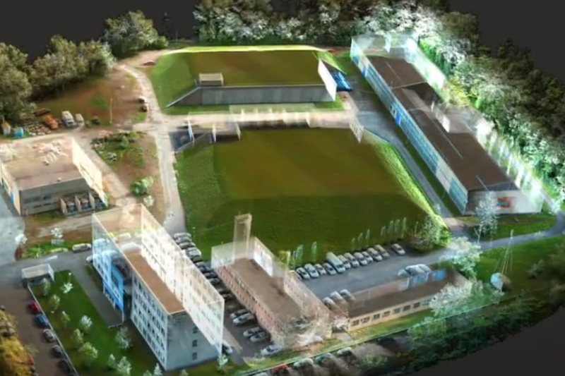
Construction and BIM
Capture as-built conditions at walking pace and use the point cloud for BIM modeling, progress checks and CAD drawings.
-
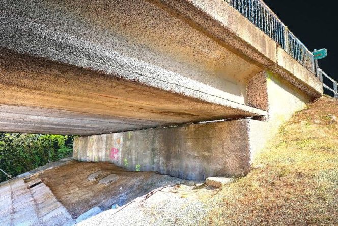
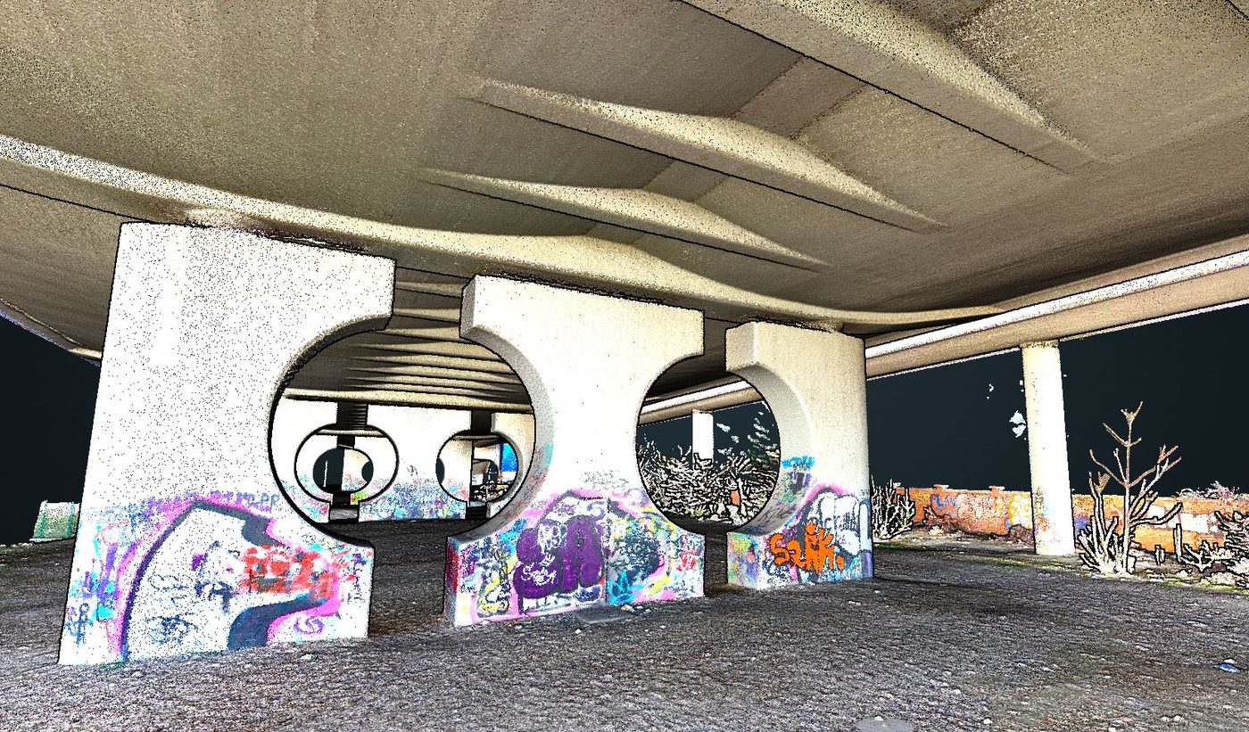
Bridges and infrastructure
Scan under bridge decks and along supports, where GNSS is blocked, with shorter lane closures during regular inspections.
-
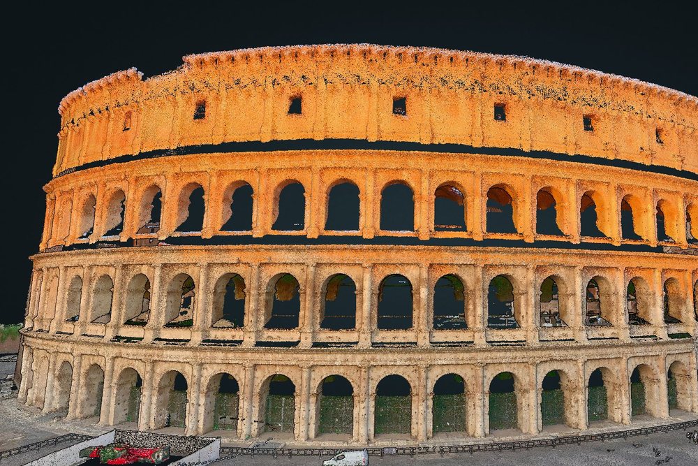
Cultural heritage
Document facades, arcades and interiors in color, with 360° panoramas for archives and restoration. The Colosseum in Rome was scanned with the Lidaretto H32S.
-

Stockpiles and earthworks
Walk around stockpiles and excavations and calculate volumes and profiles in Lidaretto Innovator, with DTM from the same data.
-
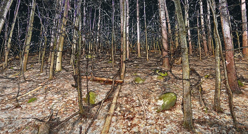
Forestry and tree management
Walk the stand under the canopy, where GNSS is weak, and measure trees and terrain directly in the point cloud.


See SLAM scanning in action
Watch a site captured on foot with Lidaretto H32S(X). No tripod and no GNSS, just a walk through the space.
From the walk to the deliverable
Lidaretto H32S(X) records the site. Lidaretto Creator & Innovator turn the recording into what you hand over. Both are two-in-one desktop software and do not rely on external cloud services.

Lidaretto Creator
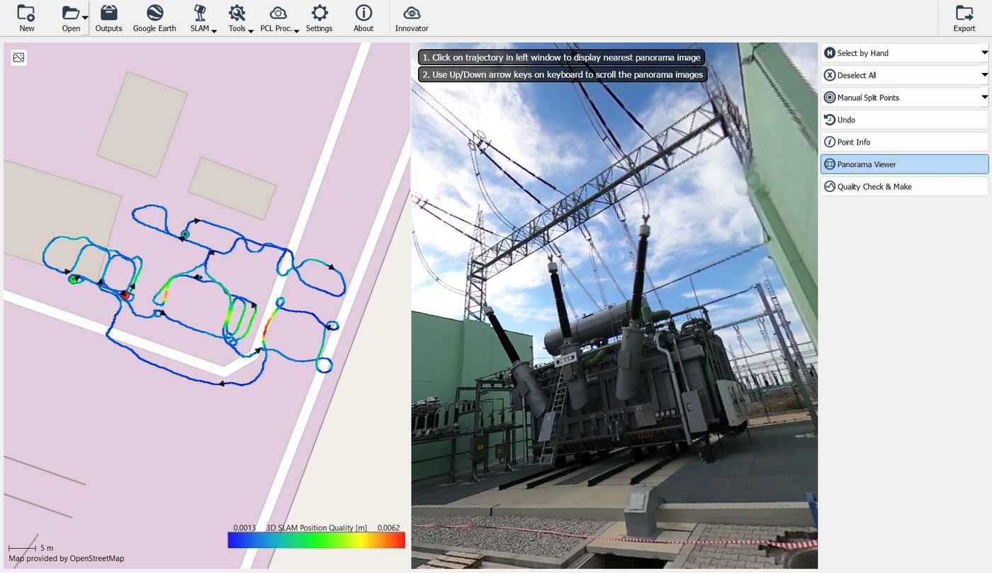
Process captured data. From the recorded walk to a clean, quality-checked point cloud.
- SLAM processing and georeferencing
- RGB colorization from the 360° camera
- Coordinate system management, variable export options
Lidaretto Innovator
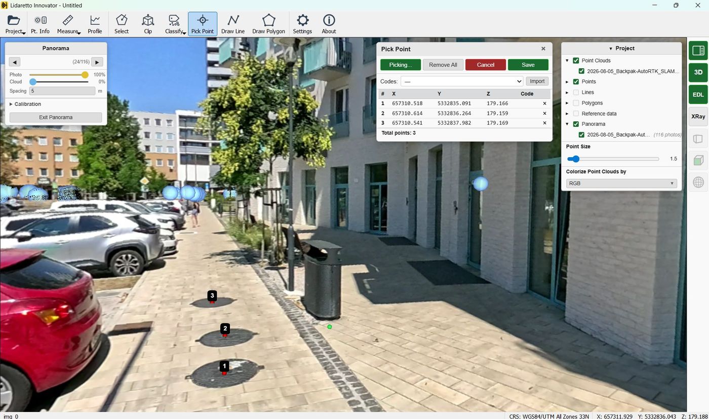
Deliverables. Measure, classify and draw on the point cloud for CAD.
- Pick points, draw lines and polygons, profile tool
- Measure distance, area and volume
- Classification, DTM and DSM, merging and registration
Questions about Lidaretto H32S(X)
Does the H32S need GNSS?
No. SLAM builds the map from the Lidar and IMU data as you move, so the H32S works indoors and outdoors without need for GNSS.
Can I colorize the point cloud?
Yes. The 360° camera with 8K resolution enables point cloud colorization and panorama export. Lidaretto Creator adds RGB colors to the exported point cloud.
Is the software cloud-based?
No. Lidaretto Creator & Innovator are desktop applications that work without relying on external cloud services.
What is the difference between H32S and H32SX?
The Lidar module only. H32S uses Hesai XT32 with 120 m range and 2 returns. H32SX uses Hesai XT32M2X with 300 m range, 3 returns and a lower weight of 1.2 kg instead of 1.5 kg.
SLAM only, or PPK as well?
Same Hesai Lidars, same software. The difference is how the scanner positions itself and where you carry it.
Swipe sideways to compare both scanners.
| Lidaretto H32S(X)This page | Lidaretto H32(X)PPK and SLAM | |
|---|---|---|
| Positioning | SLAM only | PPK & SLAM |
| GNSS | Not needed, works without GNSS | NovAtel INS: GNSS and IMU |
| Lidar | Hesai XT32 or XT32M2X | Hesai XT32 or XT32M2X |
| Carrying | Handheld, harness, backpack | UAV, car, backpack, handheld, ... |
| Camera | Detachable 8K 360° camera | Various optional 360° cameras |
| Request a quote | See Lidaretto H32(X) |
Get a quote for Lidaretto H32S(X).
Tell us where you scan and what you deliver. We will get back to you with a quote and the configuration that fits: H32S or H32SX.
Other Lidaretto products
One software suite, multiple scanners. Pick by your requirements and budget.
Lidaretto H32(X)
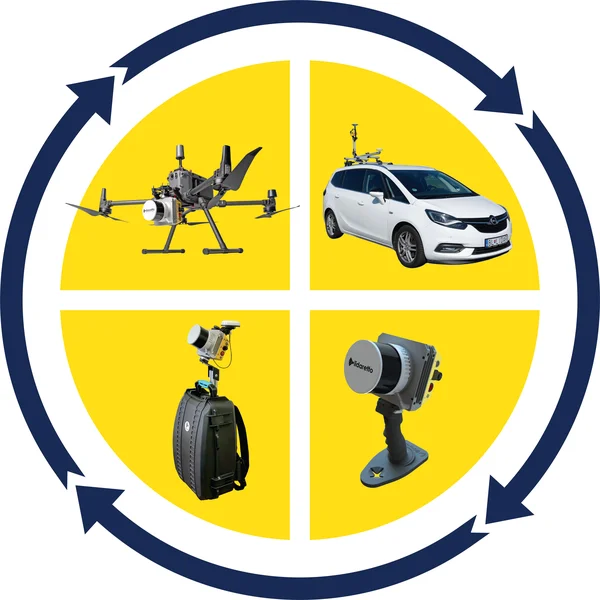
PPK and SLAM with Hesai XT32(M2X). For UAV, car, backpack or handheld scanning.
See Lidaretto H32(X)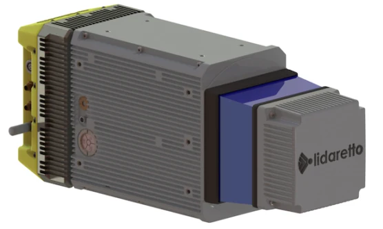
Lidaretto CL360HD
Built around the Teledyne Optech CL-360HD for high-detail long-range mobile mapping.
See Lidaretto CL360H
Lidaretto Software
Lidaretto Creator for producing the point clouds, Lidaretto Innovator for visualization and processing .
See Lidaretto Software